City of Clovis Comprehensive Plan

Our most recent project, an update to the City of Clovis Comprehensive Plan, was adopted by the City Commission on December 13, 2018. The Comprehensive Plan established an overall vision for the community’s physical development, economic health, and well-being with an assumed planning horizon of 20 years. Consensus Planning lead a robust public engagement process that included meetings and interviews with a Steering Committee, stakeholder groups, City staff, general public, and an online community survey. The intent and purpose of the Comprehensive Plan was to:

  • Provide an overall framework to advance Clovis forward in a clear, coordinated, and effective manner to achieve the community’s vision;
  • Provide guidance regarding growth, development, and capital investments for public infrastructure and facilities;
  • Strengthen existing neighborhoods and encourage quality development and new investment by the private sector;
  • Build upon and leverage the City’s existing strengths and opportunities to bolster the economy;
  • Encourage community participation in an open and consensus-building planning process; and
  • Maintain and nurture partnerships with other local and regional entities to address community needs and implement the Comprehensive Plan.

One of the key recommendations of the Comprehensive Plan was to designate two areas in Clovis as Metropolitan Redevelopment Areas (MRA). The City Commission acted on the recommendation by designating the two MRAs, successfully applying for a community planning grant from the New Mexico Finance Authority, and contracting with Consensus Planning in May 2020 to complete the plan.
 

Santolina

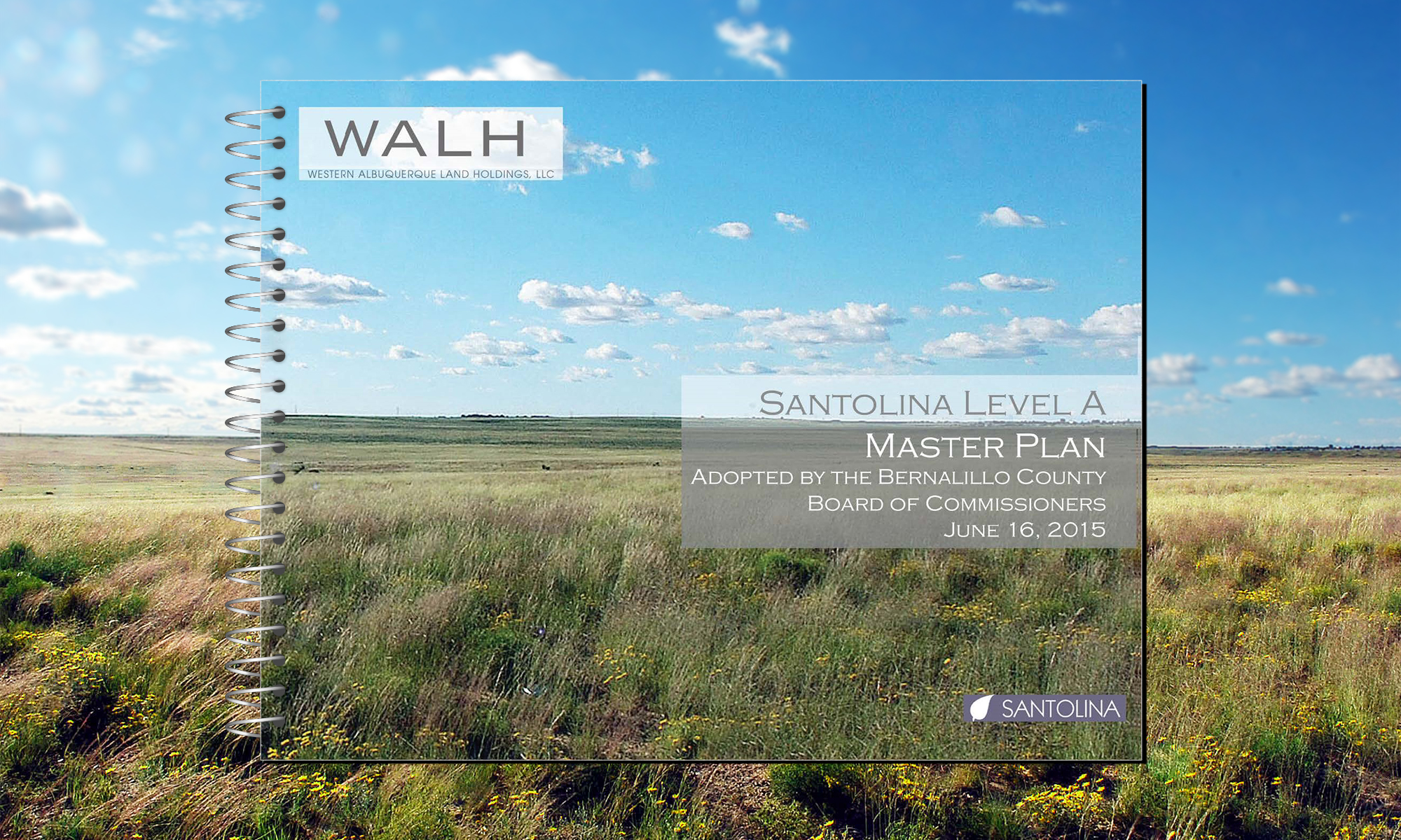
Consensus Planning prepared a Level A Planned Community Master Plan and zoning for approximately 13,700 acres of land located within the unincorporated portion of Bernalillo County, west of Albuquerque. The Project Team included Garrett Development, Consensus Planning, Rodey Law Firm, Bohannan Huston, and SEC Planning (Austin, TX). Preliminary efforts included research regarding the latest trends in planned communities, working with the County staff to reinstate the Planned Communities Criteria (PCC), and developing a “why here, why now” presentation regarding regional growth opportunities and constraints.

The Level A Plan was designed as a mixed-use, self-sufficient community with a series of village areas planned for residential development, an urban center, a town center, and business and employment areas. A key feature of the plan was a focus on future employment areas to help alleviate the current jobs/housing imbalance on the west side of Albuquerque. Santolina was the first Level A Master Plan approved following County’s re-adoption of the PCC in 2012. The project included a separate justification and zone map amendment request to change the entire property from A-1 Zoning to PC – Planned Community. The review and approval process were controversial, with several anti-growth organizations and South Valley farmers mounting a public campaign opposing the project. Consensus Planning worked closely with County staff and the Project Team to ensure that every criterion was completely satisfied, which resulted in a recommendation for approval by staff and the County Planning Commission to the Board of County Commissioners (BCC). Consensus Planning also supported the Rodey Law Firm’s efforts to negotiate the companion Level A Development Agreement as required by the BCC. The Level A Master Plan, zone map amendment, and Level A Development Agreement were approved in 2015.

Following the approval of the Level A Master Plan, Consensus Planning designed and led the entitlement effort for the first Level B Plan (approximately 4,000-acre portion of Santolina). The Level B Plan included a significant amount of open space, parks, residential neighborhoods, as well as a portion of the urban center, town center, business park and industrial area. It also included custom zoning and design standards for the property. The Level A and Level B plans provide all the elements needed for a new community – land use, zoning, design standards, utilities, transportation, open space, and public services. Similar to the Level A Plan, the Level B Plan also required a Level B Development Agreement, which was negotiated by the Rodey Law Firm with Consensus Planning’s assistance and approved along with the Level B Plan.

Indian Pueblo Cultural Center Master Plan

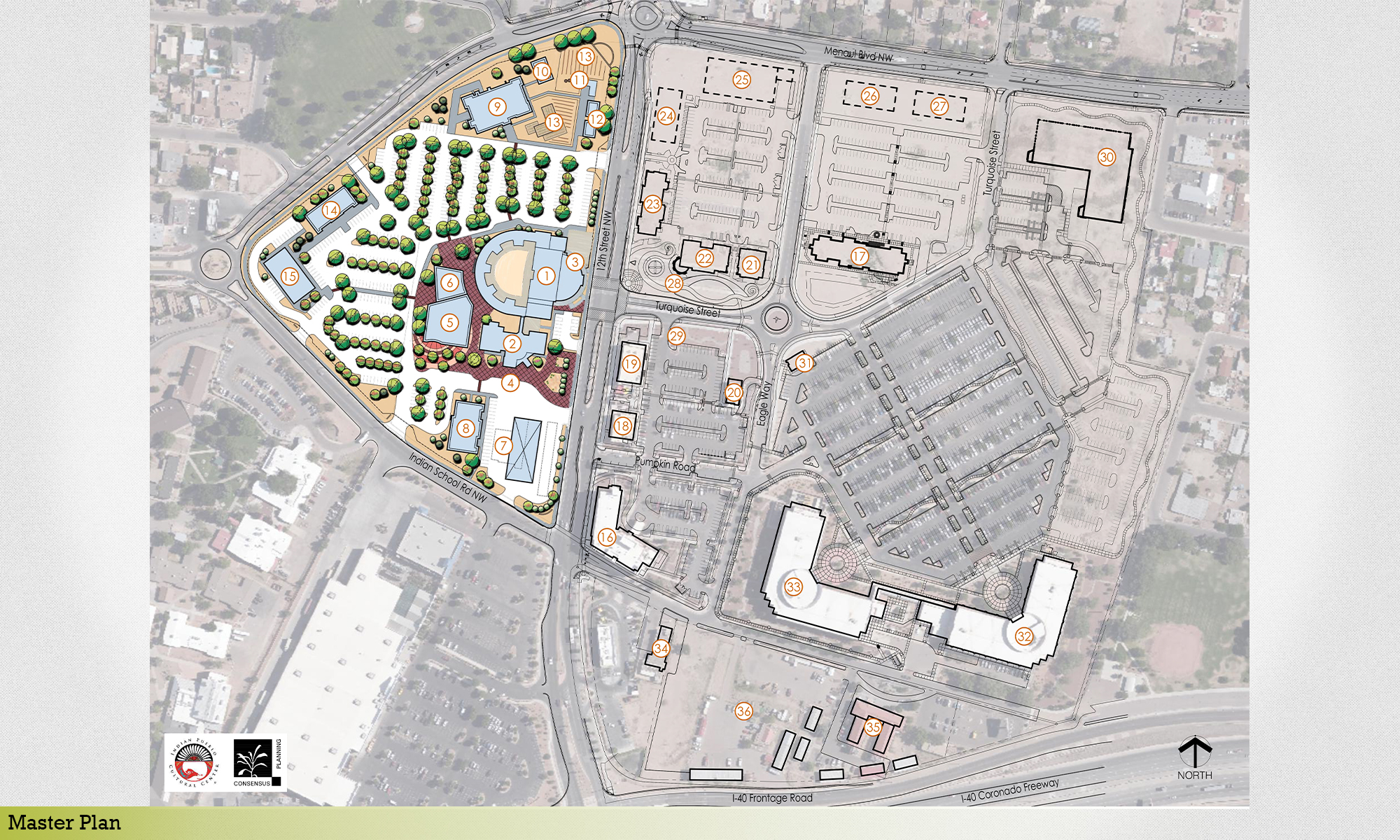
The Indian Pueblo Cultural Center Executive Management Team engaged Consensus Planning to assist in preparing a Master Plan for its property and to specifically consider how the campus could expand over time with new buildings and parking, improved pedestrian and vehicle circulation, and improved wayfinding. The Indian Pueblo Cultural Center Master Plan covered the property located on the east and west sides of 12th Street, between Menaul Boulevard and Interstate 40, in Albuquerque. The property is owned by the 19 Indian Pueblos of New Mexico and managed by the Indian Pueblo Cultural Center (IPCC). Today, the IPCC stands as the gateway to the Pueblos of New Mexico, providing the opportunity for visitors to understand the traditional Pueblo culture through cultural, educational, and community activities and exhibits.

As the IPCC campus developed over time, it became apparent that the campus, particularly on the west side of 12th Street, needed a fresh look to determine how to improve the physical condition. The Master Plan was the result of a several month planning process with participation from IPCC management and employees. The planning process included research and analysis of existing site conditions, previous studies, and future development plans; a visioning workshop; preparation of site layout alternatives and wayfinding concepts; and a preferred Master Plan layout based on feedback from the IPCC management team. The Consensus Planning gave a presentation of the Master Plan to the IPCC Governing Board.

The Indian Pueblo Cultural Center (IPCC) Master Plan focused on the west side of the property and identified areas for development of new buildings, a reconfiguration of parking and site circulation, and redevelopment of the Four Winds Travel Center. The changes to the east side were limited to wayfinding and signage as all of this property is either developed or planned for future development with conceptual layouts created by other consultants. The Master Plan provided a long-term development strategy and assumed the improvements will be phased over time as funding becomes available for development.

Upper Petroglyphs

Consensus Planning worked on the Westland North Master Plan in the mid-1990’s, which resulted in the City’s acquisition of the Atrisco Terrace Open Space. In 2016, Consensus Planning worked with the new property owners, Western Albuquerque Land Holdings and Bernalillo County to create a new Sector Plan for the unincorporated portion of the old Master Plan. In 2019, this plan was updated to respond to detailed master planning for the residential portion of the plan area. This plan will build on the significant success es on the City portions of the master plan (Lower Petroglyphs – below the Atrisco Terrace) including the Albuquerque Regional Sports Complex, Del Webb Mirehaven, APS’ Nusenda Community Stadium and the new Tres Volcanos Community School, proposed hospital, Inspiration Planned Neighborhood, and numerous residential neighborhoods. Consensus Planning worked collaboratively with Garrett Development Corporation, Bohannan Huston engineers, SEC Planning, and Paragon Engineering Group to develop a residential master plan for approximately 3,000 acres.

The property is located on the mesa top, adjacent to the Atrisco Terrace Open Space and the Petroglyph National Monument. Consensus Planning integrated the new master plan into an amendment to the County Sector Development Plan. Due to the extensive amount of infrastructure required, the Project Team was challenged with developing a detailed phasing plan that balanced product differentiation, amenities, and absorption with infrastructure costs. The phasing included coordination with the approved PID and TIDD districts and development of a detailed financial model. Consensus Planning led an extensive interactive process with County staff including planning, parks and open space, public works, and economic development. Consensus Planning also coordinated with City Open Space and Petroglyph National Monument staff regarding the Atrisco Terrace and issues regarding trail heads, trail system planning, and roadway and drainage improvements. The updated plan received unanimous approval by the County Planning Commission and the Board of County Commissioners.

In 2020, Consensus Planning worked with BH Devco on changes needed to accommodate a large economic development project (known as Project Chico) within the industrial area of the Upper Petroglyphs Sector Plan. The amendments included minor zoning boundary changes and updates to the Design Standards. The economic development project is currently under construction.

Cabezon

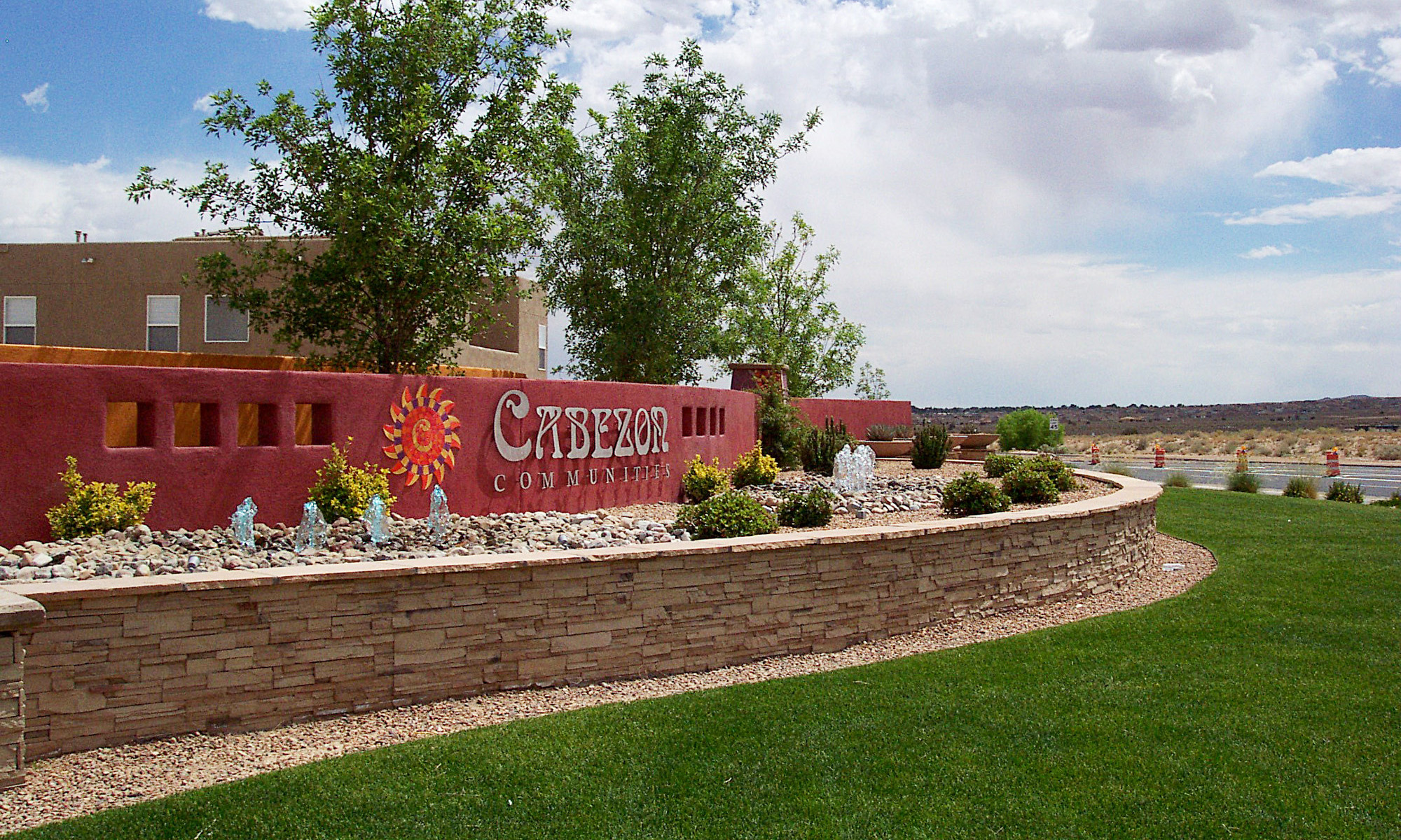
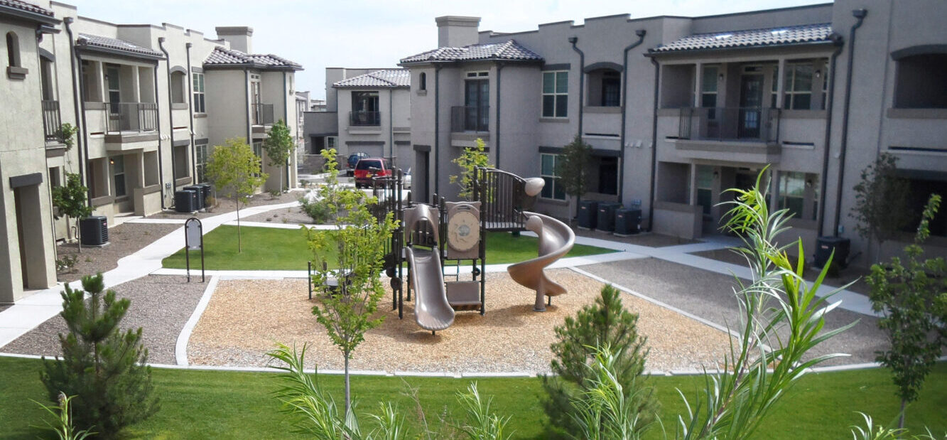
Consensus Planning prepared a Master Plan for 900 acres designated as the Unit 16 Redevelopment Area by the City of Rio Rancho, the largest metropolitan redevelopment project in the State of New Mexico. Consensus Planning assisted the master developer, CURB, Inc., in all aspects of this redevelopment project, including preparation of the original concept plan for the site, and amending the redevelopment plan. Consensus Planning assisted with the entitlement phase and developed the Master Plan for Cabezon, coordinated project branding, logo and theming development, and created design concepts for the community parks, entry monumentation and streetscapes. Community design standards were also developed to ensure aesthetic quality was maintained throughout the community.

An exciting addition to the Cabezon community is A Park Above, an all-inclusive park, designed to a higher level of accessibility than standard ADA requirements so that physical and social barriers are eliminated and people of all ages with disabilities will be able to enjoy the park and have the same opportunities for play as those without disabilities. The park includes a plethora of amenities, responding to a broad range of disabilities and abilities.

Anderson Farm

Farm Fields

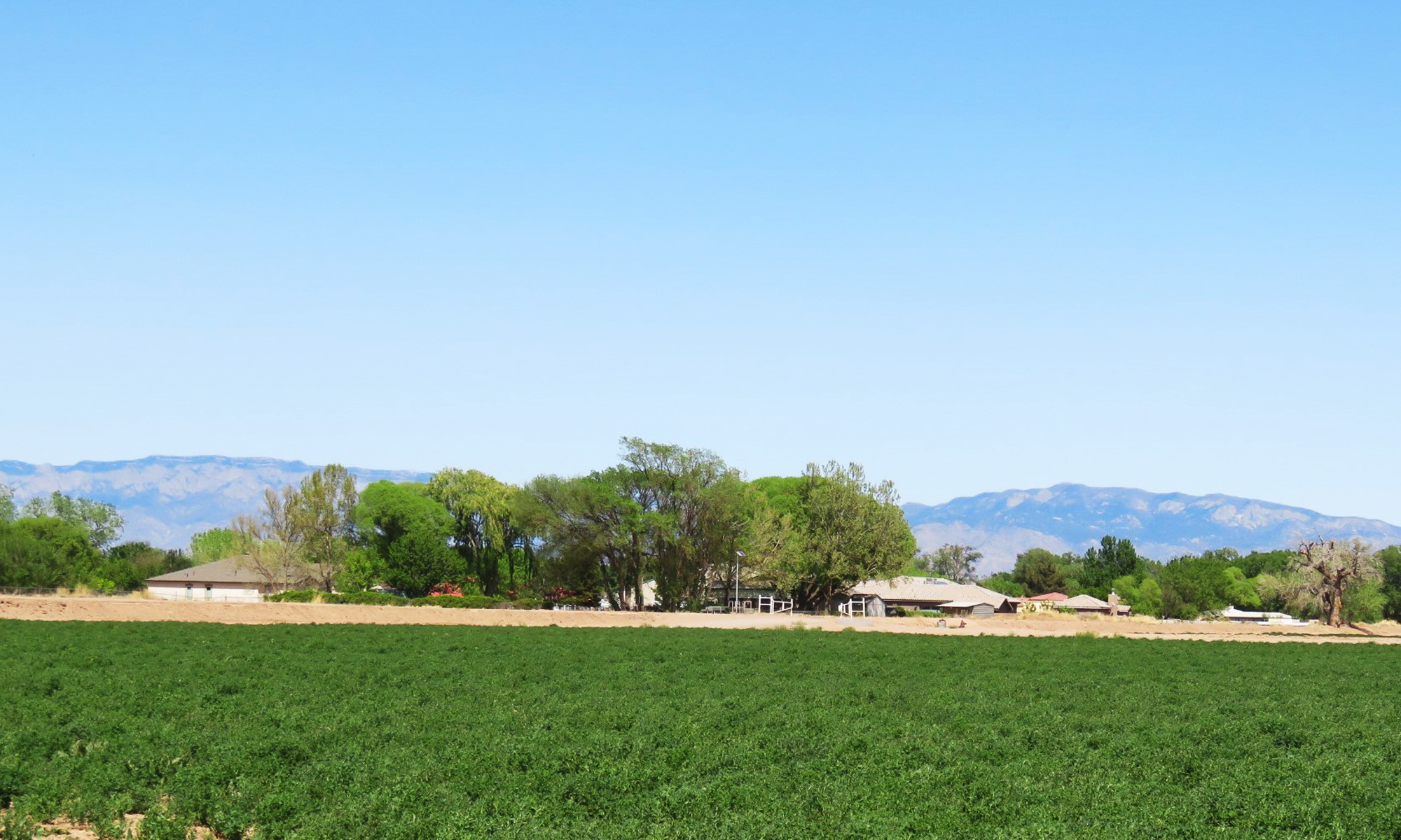
Anderson Farm is a 300-acre property located in the South Valley of unincorporated Bernalillo County and adjacent to a major, mixed-use shopping center. The property currently consists of irrigated alfalfa fields that are bisected by irrigation ditches and drainage canals. The challenge was to create a planning and zoning framework that balances the County’s desire to preserve a significant portion of the property as agricultural open space while ensuring that reasonable development can take place to make the entire project financially feasible for both the developer and the County.

Consensus Planning assisted the developer in building a collaborative team of Bernalillo County elected officials and leadership; County Planning and Open Space staff; adjacent neighborhood associations; and homebuilders to create a common vision. A Sector Development Plan was created to accomplish the preservation of 180 acres of agricultural open space through a combination of County acquisition (at a reduced cost) and dedication of additional open space using the County’s cluster development process; zoning entitlements to allow for 450 homes with interior open space, trails, and a private park; and the preservation of the main irrigation canals and drainage canals as an informal trail system. The private park will be used to acknowledge and celebrate the history and contributions of Clinton P. Anderson and the agricultural heritage of the area. The plan and purchase of 147 acres of open space were unanimously approved by the Bernalillo County Commission in December 2019.

Andalucia

Andalucia, an award-winning master planned community, is located east of Coors Boulevard, between Montano Road and Namaste Road. The primary goal for Andalucia is to create a pedestrian-oriented, mixed use and mixed residential density community highlighted by open space, lush landscaping, and a network of connections to the Rio Grande Bosque and the City’s trail system, park, and trailhead. A high level of attention was given on all of the projects within Andalucia to view preservation, protection of archaeological sites, and providing connections between the various land uses through the community trail system.

Some of the features of this special community include tree-lined entries from Coors Boulevard, a village green that runs through the center of the single family area fronted by alley loaded homes; special setbacks and street standards; low level lighting; open space areas and trails; and a 2.6 acre neighborhood park that runs along the San Antonio Arroyo. The landscape, perimeter wall, and trail designed along Coors Boulevard contains a rich palette of colors, materials, berming, view fencing, and projections and deep recesses in the wall to give pedestrians, motorists, and residents of the community an enhanced and breathtaking view of the Sandias, Manzanos, and the Bosque. The landscape features a sustainable and drought tolerant plant palette, with an emphasis on low growing shrubs and groundcovers to maintain views, and select tree specimens to frame views.

Balloon Fiesta Park

Balloon Fiesta Park is Albuquerque’s premier balloon launch site and multi-use, regional, recreational, and cultural park complex. It is the home of the Albuquerque International Balloon Fiesta, an annual nine-day event that attracts visitors and balloonists from across the world. In 2011, the event was estimated to have had a $90 million economic impact to New Mexico, including $15 million in tax revenue. In 2012, Consensus Planning completed an update to the 1998 Balloon Fiesta Park Master Development Plan (also prepared by Consensus Planning) on behalf of the City of Albuquerque Parks and Recreation Department. The revisions responded to the input received during the planning process from the Balloon Fiesta Park Commission, Albuquerque International Balloon Fiesta, City staff, neighborhood representatives, other stakeholders, and the general public. The Master Development Plan was unanimously approved by the City’s Environmental Planning Commission.

In addition to the Master Development Plan, Consensus Planning has provided landscape design services for the Sid Cutter Pilots’ Pavilion and sculpture, and the Balloonists Tribute Area adjacent to the Balloon Museum, which has included several art installations. We continue to work on exciting improvements that are in the programming phase, including relocation of the Bus Depot, landscape and activity improvements to the east slope area, and a potential extreme exercise circuit.

Truth or Consequences

The City of Truth or Consequences, located in Sierra County, New Mexico, is known for being an edgy resort town featuring hot mineral springs, alternative medicine, and an eclectic arts scene. Consensus Planning completed three separate planning documents for the City in 2014, including the Downtown Master Plan / Metropolitan Redevelopment Plan, Comprehensive Plan, and Affordable Housing Plan.

For the Downtown Master Plan, Consensus Planning facilitated a robust and customized public engagement process with several methods of gaining public input, including hosting a public meeting during a Downtown Second Saturday Art Hop, a public open house, workshops, and a walking tour. The Master Plan identified redevelopment strategies and catalytic projects that were designed to spur reinvestment, move the MainStreet District forward to a more prosperous future, and celebrate the unique and historic character of Truth or Consequences.

The Comprehensive Plan was an update to the 2004 Comprehensive Plan, also completed by Consensus Planning. The planning process included four public meetings, a City Commission workshop, and the creation of new and revised goals, objectives, and implementation strategies, which form the basis for the updated Comprehensive Plan.

The Affordable Housing Plan was designed to follow the New Mexico Mortgage Finance Authority’s requirements, which included a Community and Housing Profile, Housing Needs Assessment, Land Use and Policy Review, and Goals, Policies, and Quantifiable Objectives. As part of the housing needs assessment, Consensus Planning also performed a windshield survey to evaluate existing housing conditions. Public input for the Affordable Housing Plan was incorporated into the Comprehensive Plan process.

North Domingo Baca Park and Multi-Generation Center

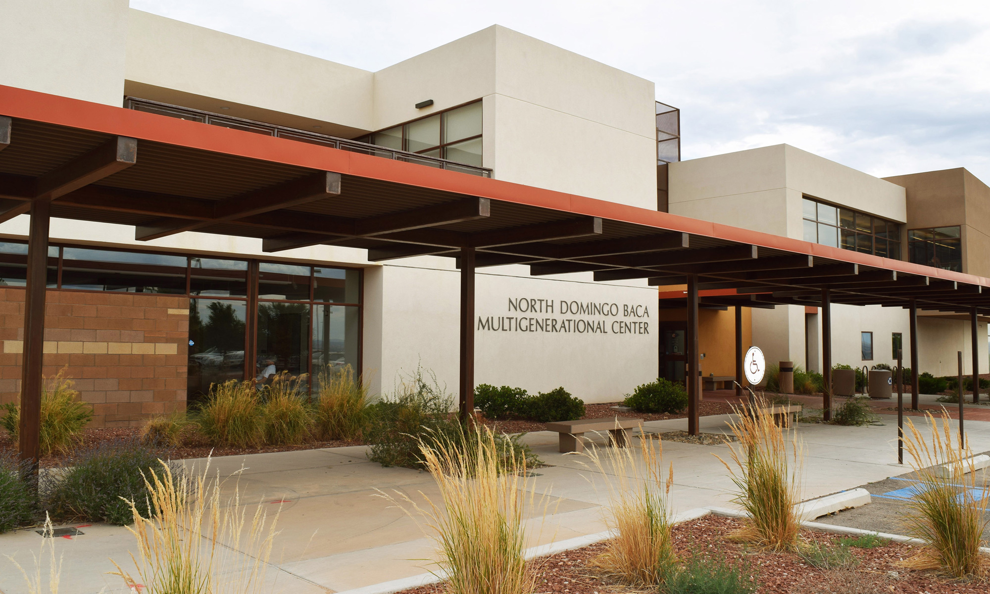
Consensus Planning has been providing landscape architecture, planning, and construction management services for this park facility since 1997 … and we’re still at it! Our services started with a Master Development Plan for this 58-acre site in North Albuquerque Acres. The property is owned by the City of Albuquerque and is adjacent to the AMAFCA-owned Harry Kinney flood control dam. The Master Development Plan balanced significant drainage considerations, recreational opportunities, community facilities, and community desires. A steering committee of neighborhood representatives was formed to transmit the concerns of the community into the planning process. The public involvement process was extremely important in developing a facility program that responded to City and community priorities. Consensus Planning worked with a Technical Team and Public Advisory Committee to formalize the program and shape the layout of the park.

Nine phases of construction have produced an exciting multi-use park that provides something for everyone. Improvements include: a dog park, a lighted skate park, children’s play area, picnic facilities throughout the park, four multi-purpose recreation fields, six lighted tennis courts, 4 lighted handball courts, a climbing wall, three bocce ball courts, perimeter trail system, and three phases of the multi-generation center, including the recently completed gymnasium addition. Future design efforts to complete the park master plan include an aquatics facility and additional parking.